- Planet Earth
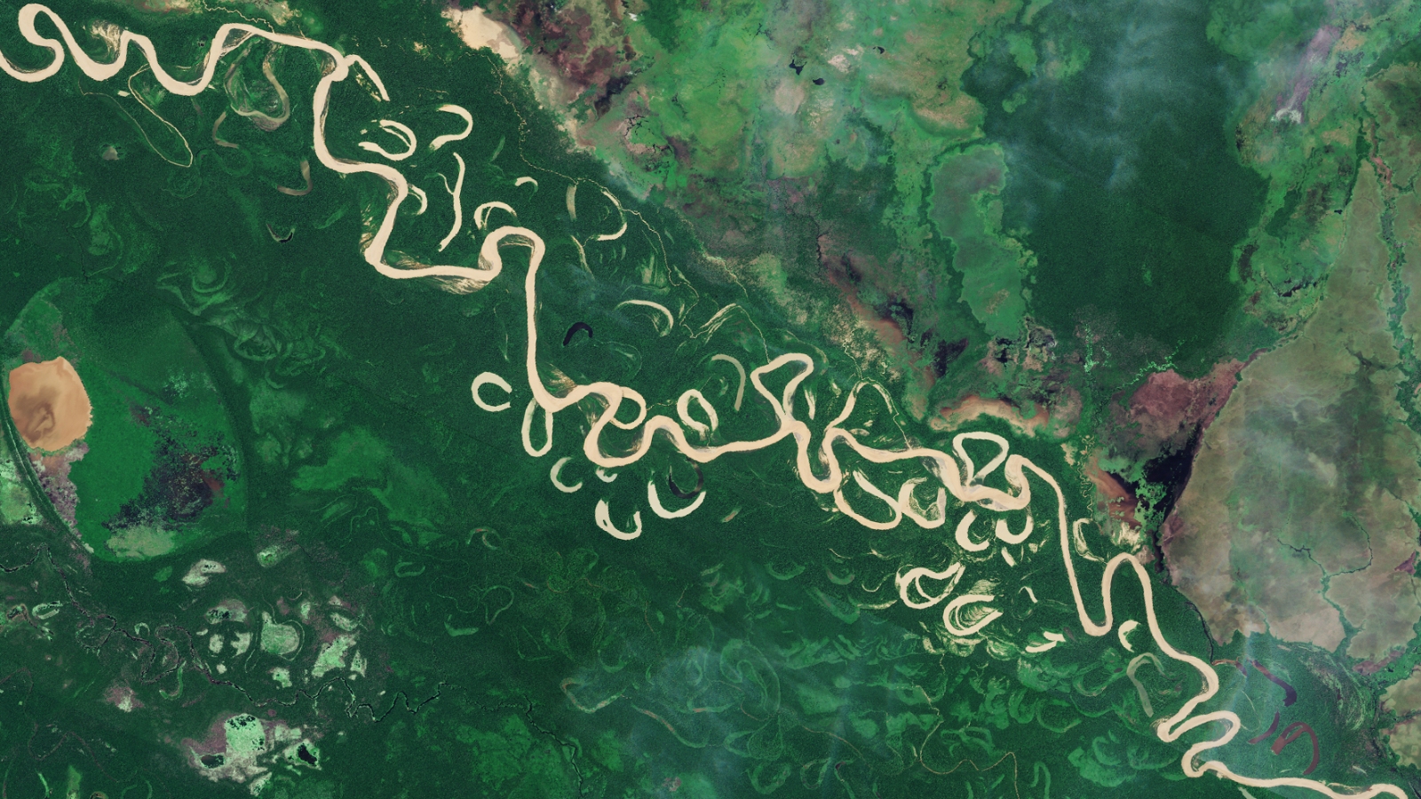
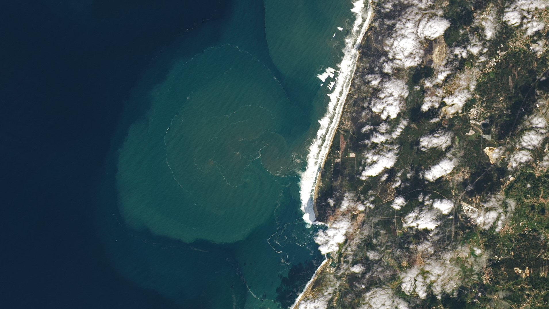
The first false-color image from ESA's newly operational Biomass satellite shows off a unique perspective of the rainforests, grasslands and wetlands surrounding a winding river in Bolivia.
When you purchase through links on our site, we may earn an affiliate commission. Here’s how it works.
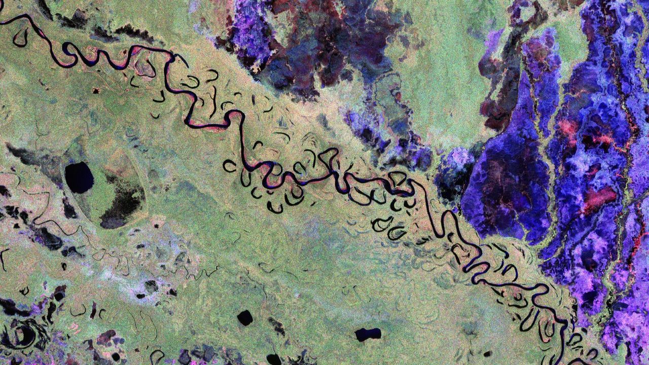
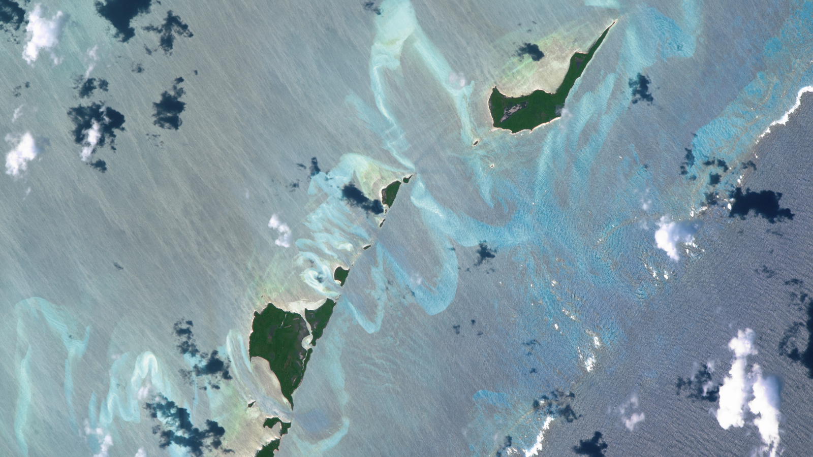
 The first, false-color image captured by ESA's newly operational Biomass satellite shows the varying types of vegetation surrounding Bolivia's Beni River. In the photo, rainforests appear green, grasslands are purple, wetlands are reddish, and water appears black.
(Image credit: ESA/Biomass satellite)
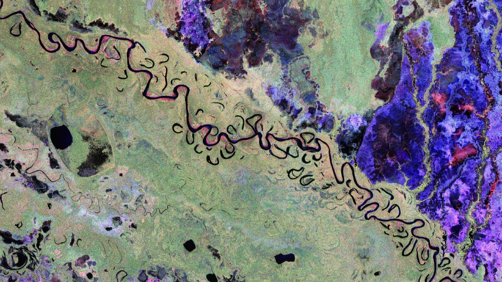
The first, false-color image captured by ESA's newly operational Biomass satellite shows the varying types of vegetation surrounding Bolivia's Beni River. In the photo, rainforests appear green, grasslands are purple, wetlands are reddish, and water appears black.
(Image credit: ESA/Biomass satellite)
- Copy link
- X
Get the world’s most fascinating discoveries delivered straight to your inbox.
Become a Member in Seconds
Unlock instant access to exclusive member features.
Contact me with news and offers from other Future brands Receive email from us on behalf of our trusted partners or sponsors By submitting your information you agree to the Terms & Conditions and Privacy Policy and are aged 16 or over.You are now subscribed
Your newsletter sign-up was successful
Want to add more newsletters?

Delivered Daily
Daily Newsletter
Sign up for the latest discoveries, groundbreaking research and fascinating breakthroughs that impact you and the wider world direct to your inbox.
Signup +
Once a week
Life's Little Mysteries
Feed your curiosity with an exclusive mystery every week, solved with science and delivered direct to your inbox before it's seen anywhere else.
Signup +
Once a week
How It Works
Sign up to our free science & technology newsletter for your weekly fix of fascinating articles, quick quizzes, amazing images, and more
Signup +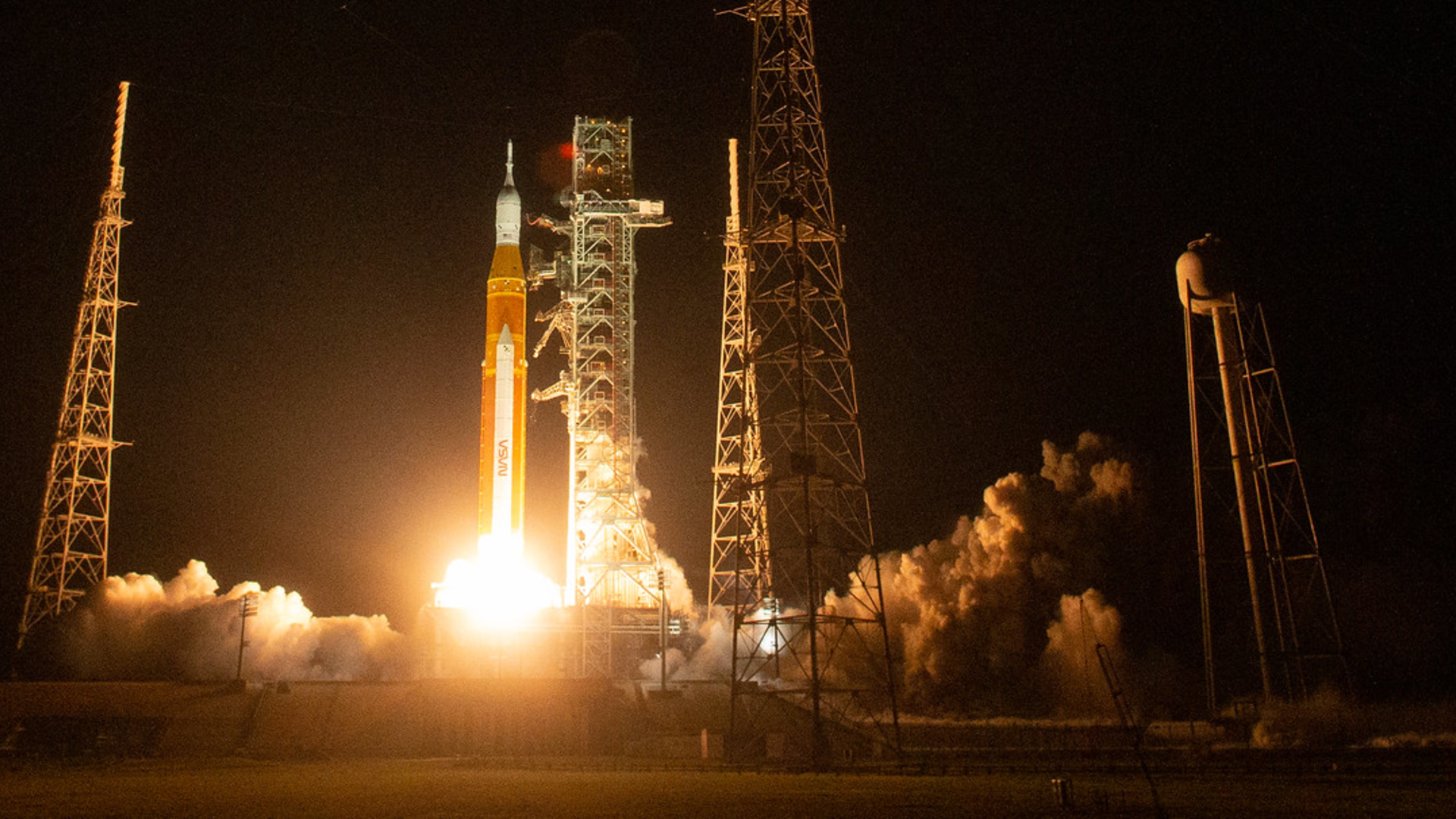
Delivered daily
Space.com Newsletter
Breaking space news, the latest updates on rocket launches, skywatching events and more!
Signup +
Once a month
Watch This Space
Sign up to our monthly entertainment newsletter to keep up with all our coverage of the latest sci-fi and space movies, tv shows, games and books.
Signup +
Once a week
Night Sky This Week
Discover this week's must-see night sky events, moon phases, and stunning astrophotos. Sign up for our skywatching newsletter and explore the universe with us!
Signup +Join the club
Get full access to premium articles, exclusive features and a growing list of member rewards.
Explore An account already exists for this email address, please log in. Subscribe to our newsletter QUICK FACTSWhere is it? Beni River, Bolivia [-11.23789979, -66.2670646]
What's in the photo? False colors representing the varying levels of biomass around the river
Which satellite took the photo? The European Space Agency's Biomass satellite
When was it released? June 23, 2025
This trippy satellite snap shows the hidden intricacies of the biomass, or carbon-rich material, surrounding a winding river in Bolivia. The first-of-its-kind image, snapped last year, shows the unique orbital perspective from one of Europe's newest spacecraft.
The striking photo shows a section of land — around 56 miles (90 kilometers) long and 37 (60 km) wide — surrounding the Beni River (or Rio Beni) in northern Bolivia. The convoluted waterway stretches approximately 680 miles (1,095 km) from its origin in the Andes, just north of La Paz, and into Brazil, where it merges with the Amazon River.
The image was snapped by the European Space Agency's (ESA) Biomass satellite, which launched April 29, 2025. This satellite scans Earth's surface using polarized radar, allowing it to detect subtle differences in biomass across the landscape.
You may like-
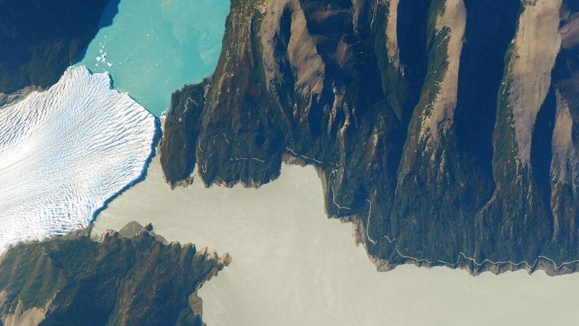 See the exact point where a glacier, a lake and a river 'touch' in Argentina
-
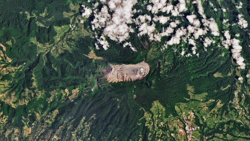 Extreme 'paradise' volcano in Costa Rica is like a piece of ancient Mars on our doorstep
-
 Rare 'sunglint' transforms Alabama River into a giant 'golden dragon'
In the image, rainforests appear green, grasslands are purple, wetlands are reddish, and the river and nearby lakes appear black. (The photo has also been flipped so that north is to the right of the photo.)
The mission's "first images are nothing short of spectacular — and they're only a mere glimpse of what is still to come," Michael Fehringer, an ESA scientist and Biomass project manager, said in a statement when the image was released.
One key goal of the Biomass satellite is to measure how Earth's carbon-rich areas are shifting in response to human pressures, such as climate change and deforestation.
For example, Bolivia is among the countries hit hardest by deforestation. But it is hard to quantify the scale of this issue using normal satellite photos, where forests, grasslands and wetlands appear to merge (see above).
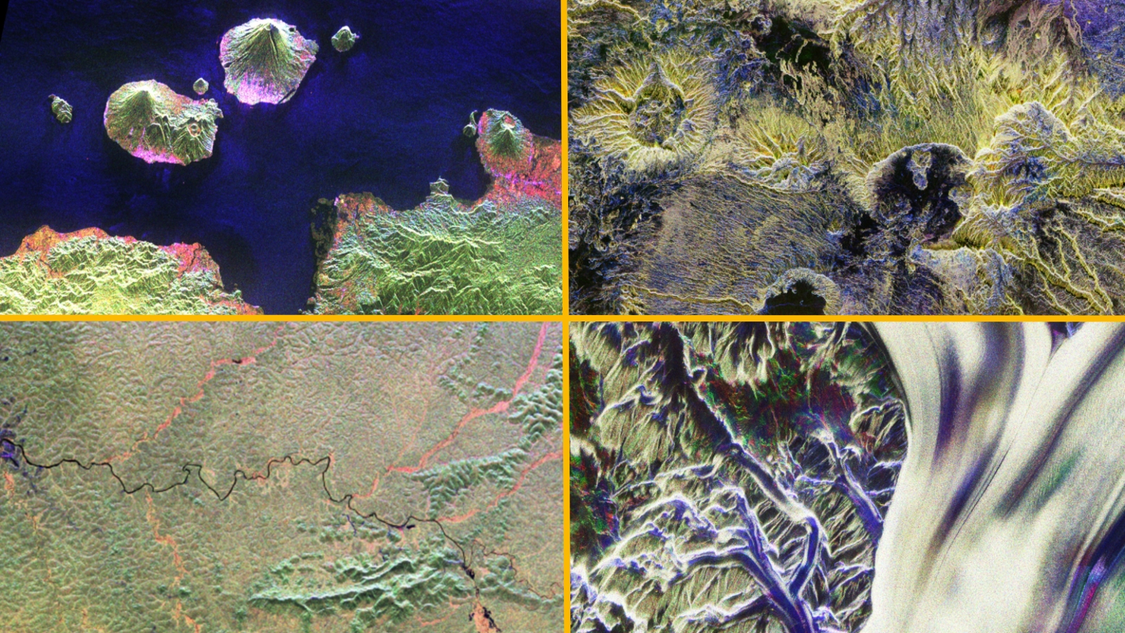
Sign up for the Live Science daily newsletter nowContact me with news and offers from other Future brandsReceive email from us on behalf of our trusted partners or sponsorsBy submitting your information you agree to the Terms & Conditions and Privacy Policy and are aged 16 or over.ESA has since revealed several more stunning images from the Biomass satellite, including snaps of Mount Gamkonora in Indonesia, the Ivindo River in Gabon, the Tibesti Mountains in Chad and the Nimrod Glacier in Antarctica.
The satellite is now fully online and will scan the entirety of Earth's forests every six months.
Biomass's radar technology will also be particularly good at penetrating and assessing ice masses, which will be an important secondary goal of the spacecraft's mission.
On Jan. 26, ESA announced that it is opening up the satellite's dataset to the public, which will allow for more research. This collaborative approach will "unlock vital insights into carbon storage, climate change, and the health of our planet's precious forest ecosystems," Simonetta Cheli, ESA's director of Earth observation programs, said in the statement.
See more Earth from space
 Sandbanks shine like auroras
A 2016 astronaut photo of the Bahamas shows a series of luminous, rippling sandbanks partly carved out by a coral reef. The image also reveals subtle differences in the ocean's surface caused by a steep, hidden ocean drop-off.
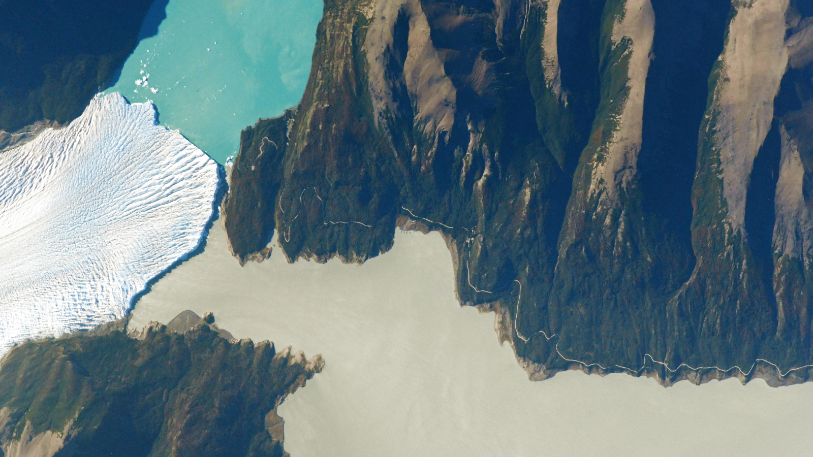 Glacier, lake and river 'touch'
A 2021 astronaut photo shows a triple valley system in Argentina's Los Glaciares National Park where a massive climate-resilient glacier, a pristine turquoise lake and a murky green "river" come together at a single point.
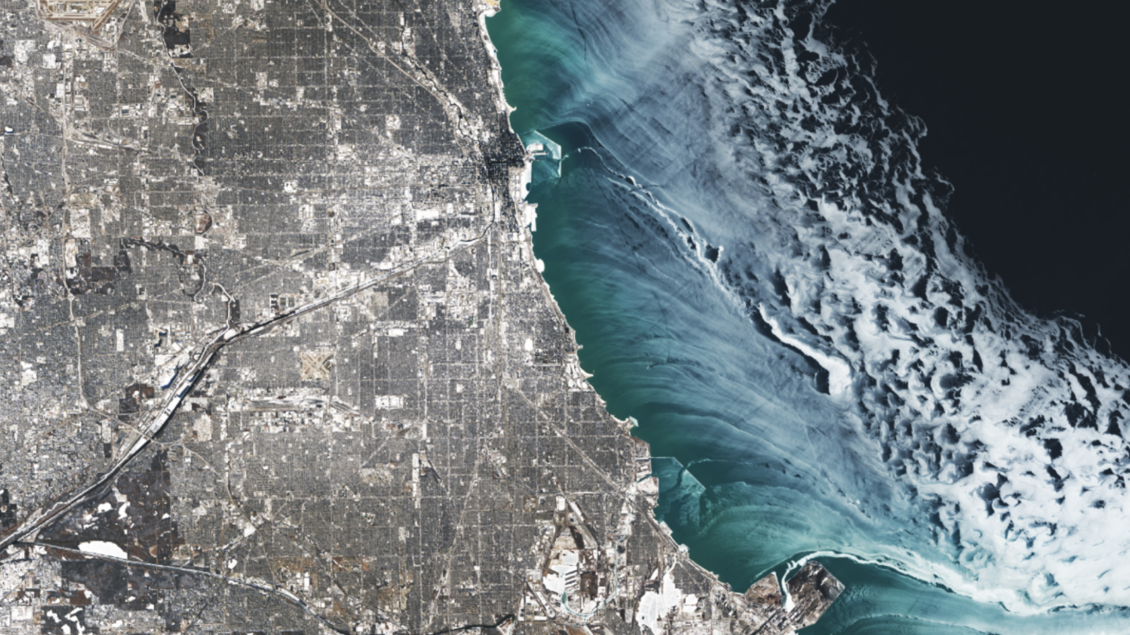 Ice swirls alongside Chicago
A 2025 satellite image shows a series of ghostly ice swirls sculpted on the surface of Lake Michigan by strong winds during an extreme cold snap that covered Chicago in a blanket of snow.
TOPICS Earth from space Harry BakerSocial Links NavigationSenior Staff Writer
Harry is a U.K.-based senior staff writer at Live Science. He studied marine biology at the University of Exeter before training to become a journalist. He covers a wide range of topics including space exploration, planetary science, space weather, climate change, animal behavior and paleontology. His recent work on the solar maximum won "best space submission" at the 2024 Aerospace Media Awards and was shortlisted in the "top scoop" category at the NCTJ Awards for Excellence in 2023. He also writes Live Science's weekly Earth from space series.
View MoreYou must confirm your public display name before commenting
Please logout and then login again, you will then be prompted to enter your display name.
Logout Read more
See the exact point where a glacier, a lake and a river 'touch' in Argentina
 Extreme 'paradise' volcano in Costa Rica is like a piece of ancient Mars on our doorstep
 Rare 'sunglint' transforms Alabama River into a giant 'golden dragon'
Submerged sandbanks shine like underwater auroras in astronaut's view of the Bahamas
Rare 'sunglint' transforms Alabama River into a giant 'golden dragon'
Submerged sandbanks shine like underwater auroras in astronaut's view of the Bahamas
 Rare dusting of snow covers one of the driest place on Earth and shuts down massive radio telescope
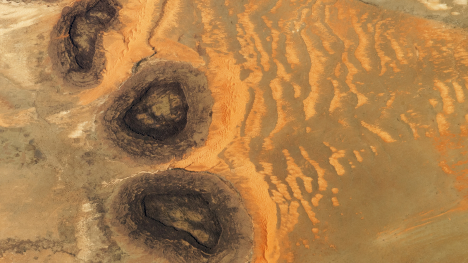 Trio of 'black mesas' leftover from Paleozoic era spawn rare sand dunes in the Sahara
Latest in Planet Earth
Trio of 'black mesas' leftover from Paleozoic era spawn rare sand dunes in the Sahara
Latest in Planet Earth
 Enormous 'mega-blob' under Hawaii is solid rock and iron, not gooey — and it may fuel a hotspot
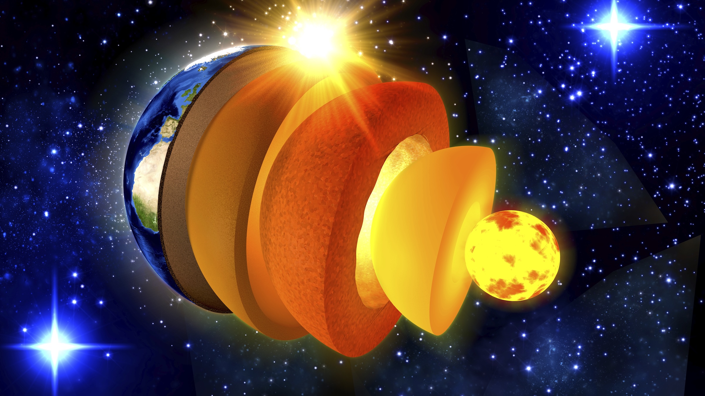 Earth is 'missing' lighter elements. They may be hiding in its solid inner core.
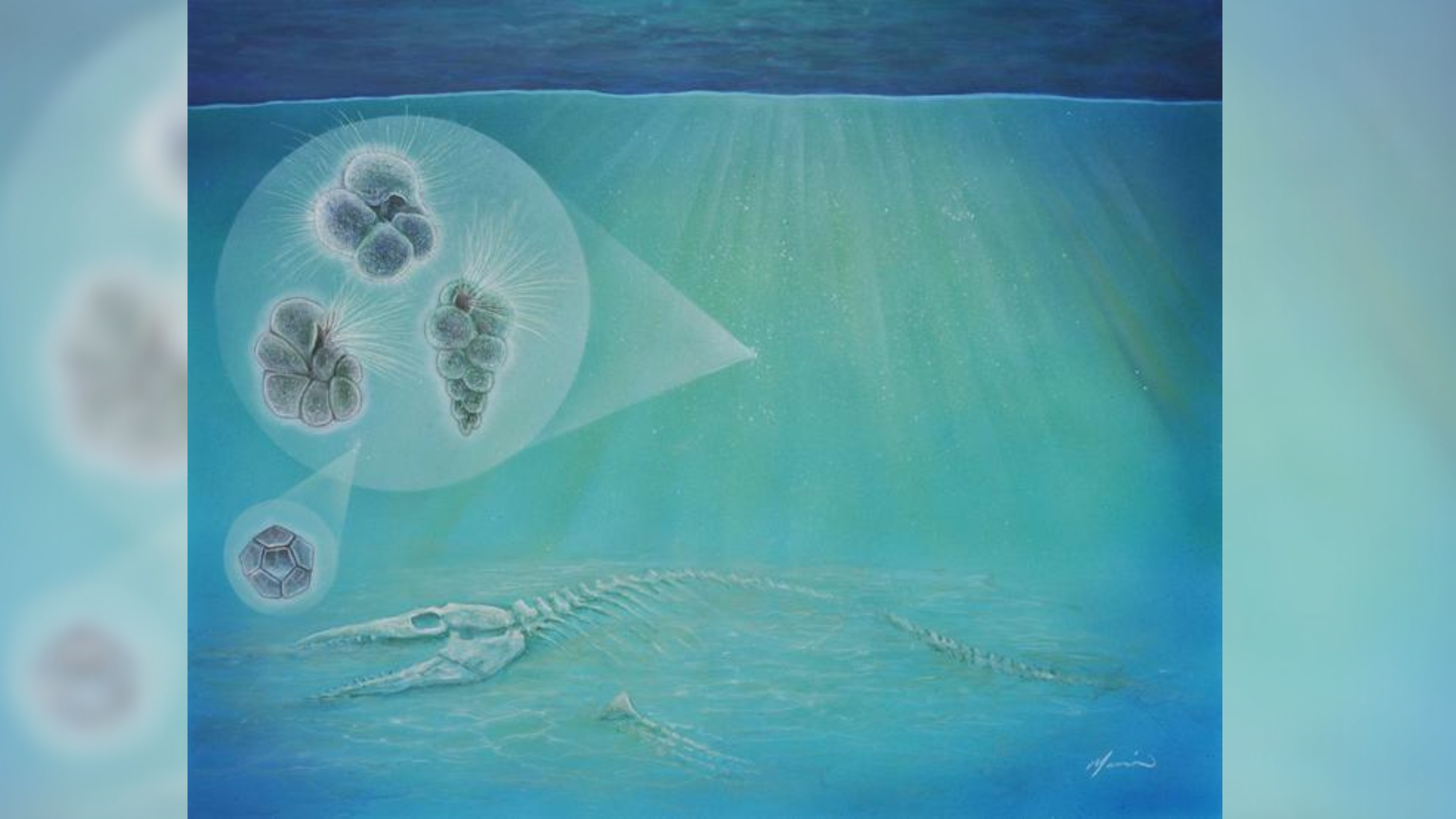 Life may have rebounded 'ridiculously fast' after the dinosaur-killing asteroid impact
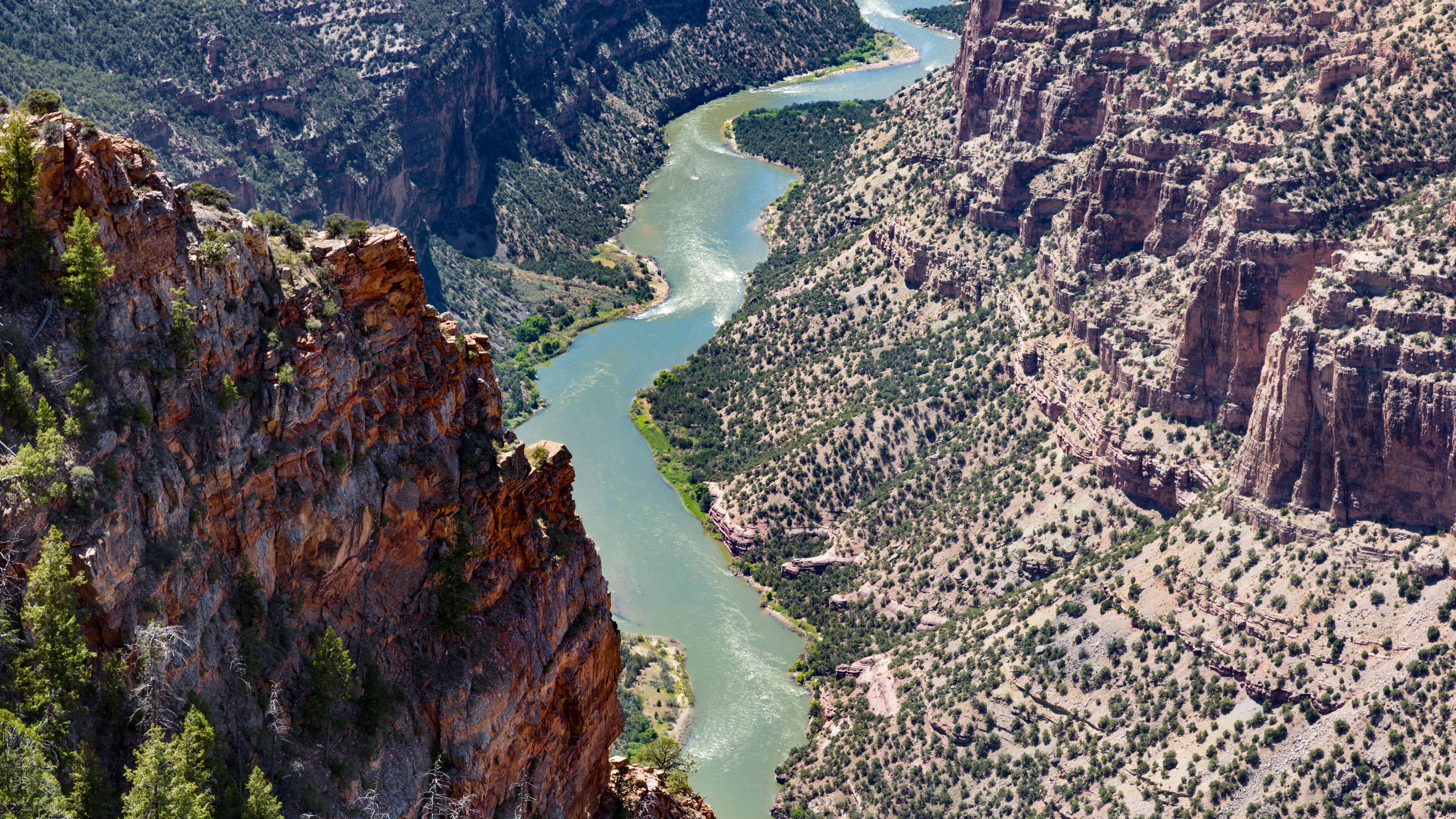 The Colorado River's largest tributary flows 'uphill' for over 100 miles — and geologists may finally have an explanation for it
 Critical moment when El Niño started to erode Russia's Arctic sea ice discovered
 'Doomsday Clock' ticks 4 seconds closer to midnight
Latest in Features
Trippy 'biomass' snap reveals first detailed look at our planet's carbon stores
'Doomsday Clock' ticks 4 seconds closer to midnight
Latest in Features
Trippy 'biomass' snap reveals first detailed look at our planet's carbon stores
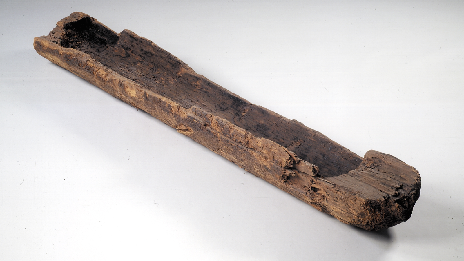 When were boats invented?
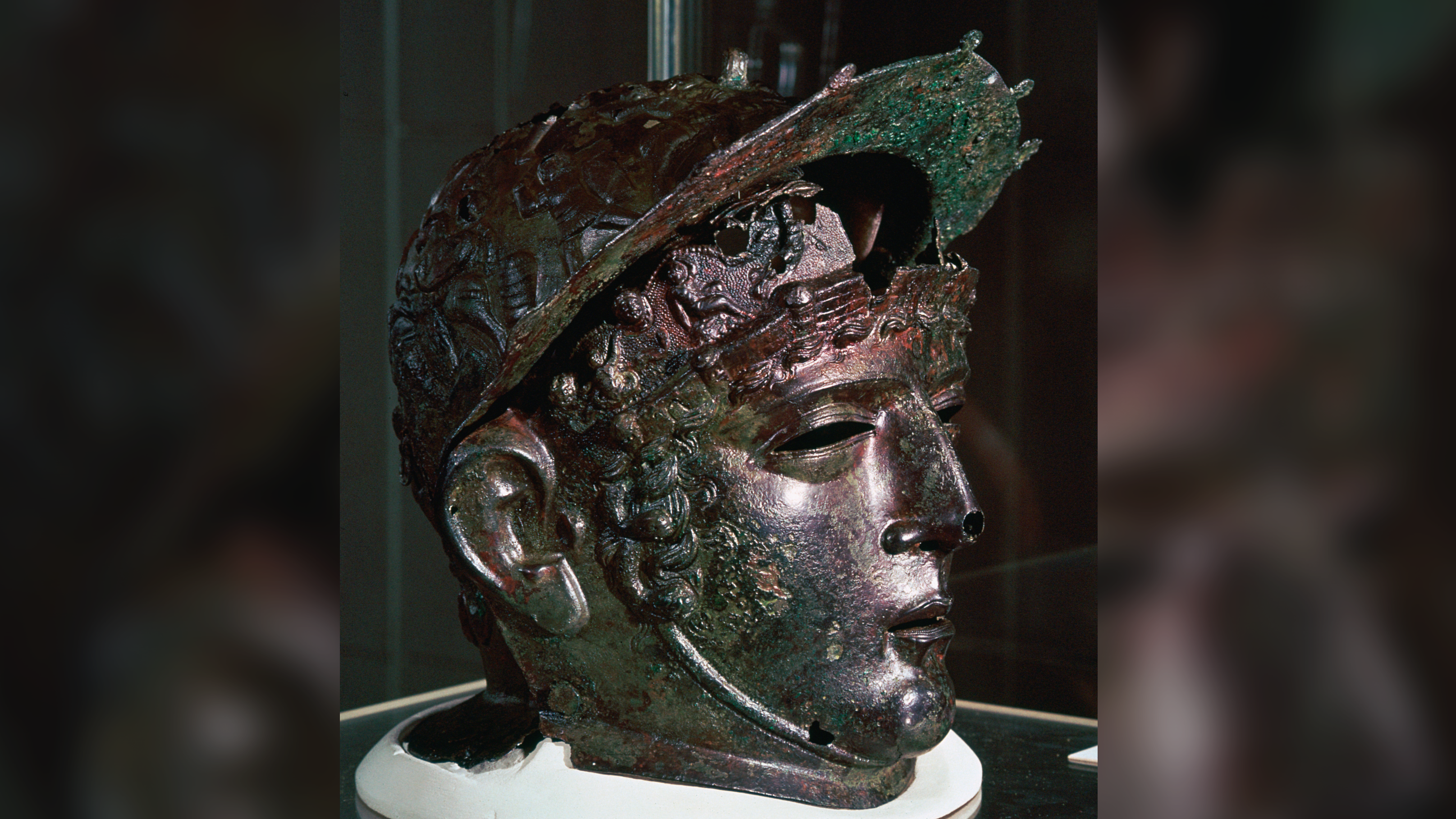 Ribchester Helmet: A rare 'face mask' helmet worn by a Roman cavalry officer 1,900 years ago
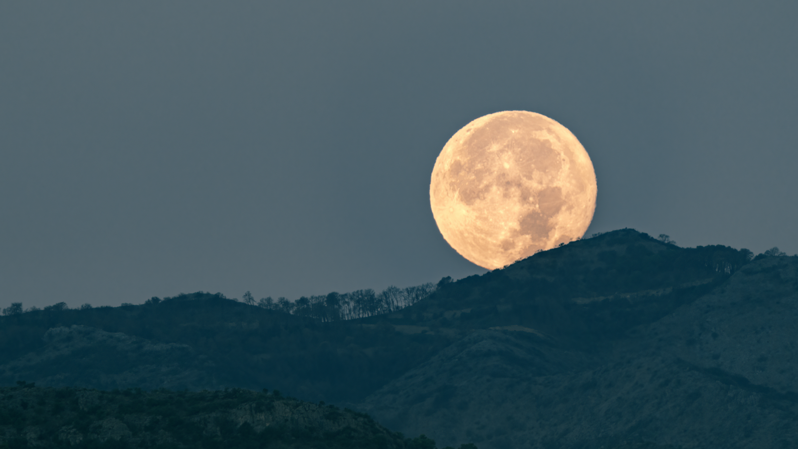 Why does the moon look larger when it's on the horizon?
 Varna Gold: Humanity's first gold jewelry was found in a cemetery with a gold 'penis sheath'
 Giant underwater plumes triggered by 7-story waves at Nazaré captured off Portuguese coast
LATEST ARTICLES
Giant underwater plumes triggered by 7-story waves at Nazaré captured off Portuguese coast
LATEST ARTICLES 1Hydrogen leak derails Artemis II wet rehearsal, pushing launch date back by weeks
- 2'Landmark' elephant bone finding in Spain may be from time of Hannibal's war against Rome
- 3Mokoqi Star Projector Night Light review
- 4'System in flux': Scientists reveal what happened when wolves and cougars returned to Yellowstone
- 5In the search for bees, Mozambique honey hunters and birds share a language with distinct, regional dialects